GPS : 45.501659, -63.344876
A relatively easy walk along an old logging/ATV trail to the rivers edge before heading upstream. The area will lead you to multiple drops each at approx 10 feet in height and falling at mostly 90 degrees. The other drops are beyond the first fall upstream within the gorge. The first fall has a large pool at its base. Your hike from where you park, round trip will be just over 5kms.
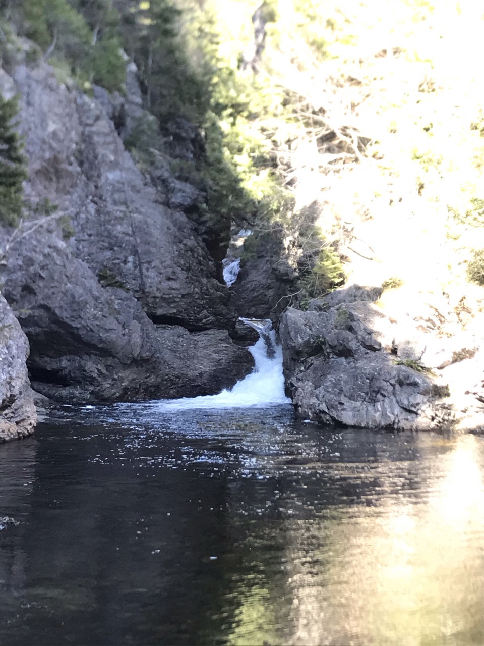
Important Information – The falls offer a nice swimming hole and small ledge to jump off. Do so at your own risk. The trail to these falls is an easy walk along an old logging/ATV trail. Once you reach the rivers edge you will have to cross the river. At this location the river is no wider than 25 feet and less than a foot deep. Once you have crossed, continue upstream around the corner. You will be able to see a continuation of the ATV trail across the river. Cross here. This location is equally as wide and deep. Follow the ATV trail all the way to the falls. At the end of the trail you can see the falls but if you would like to get closer or go swimming. You will have to cross the river once more. Equally as deep but not as wide. The area ends a deeply cut gorge that twists out of the rock face. It is unique.
Directions – These falls are located along Chiganois River in Upper Belmont area of Nova Scotia. If you are travelling from Halifax, you will want to jump on Highway 103 (Veteran’s Memorial Highway) towards Truro. Once you reach Truro, follow the Highway left towards New Brunswick. Merging onto Highway 104 (Trans Canada Highway). Driving towards Exit 13 (Debert) and turning right onto MacElmon Road. Driving past the Tim Horton’s to Plains Road and turning right. Once you are on Plains road, follow it to a left turn onto Belmont Road. Following Belmont Road until it turns into Upper Belmont Road. At this location the road turns into a gravel/dirt road. Follow this road from the pavement to gravel change location for 4kms until you reach a right hand turn that is slightly after a set of two houses close together on the right and 1 house slightly up the road on your left. It has no markings but the road veers slightly to the left. If you reach Belmont Mountain Range on your left, you have gone too far. Once you have turned right, follow this road for 2.5kms. At this point the road will take a sharp right hand turn. Do not go right. Just before where it turns right, there will be an option to go left. Don’t go left. When you pass this left option, beside the hard right turn is an option to go straight. Park safely in this area before heading straight and downhill on foot. Take the straight option which will lead you downhill before turn left. Follow this ATV trail all the way to the rivers edge. Then walk upstream to the falls.
